Mapping Fishing Activity
Mapping fishing activity within the MCZ is crucial to understanding impacts upon the rugged chalk from potting and to gain a better understanding of the importance of this habitat to the crab and lobster fishery. Eastern IFCA were aware of the importance of the rugged chalk to the fishery, however prior to 2021 we did not have spatial or quantitative data to support this. Since 2021, the Authority has been developing methods to obtain higher resolution spatial information regarding potting activities within the MCZ. This has involved the introduction of devices which provide GPS positions at regular intervals, similar to Vessel Monitoring Systems (VMS), allowing the spatial activities of fishing vessels to be tracked.
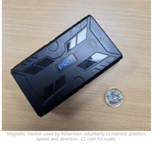
Small magnetic vehicle trackers are used to gather evidence of activity throughout the MCZ. This project started in June 2021 with one volunteer and grew to 9 volunteers in 2024 who agreed to place one of these trackers on their vessel. This equated to almost one quarter of the fleet. In April 2025, interim measures were implemented, making it mandatory for beach-launched vessels to provide positional data every three minutes. This data is collected either by trackers or IVMS. As of August 2025, 22 vessels have trackers aboard and the remainder provide positional information via IVMS. Both trackers and IVMS units submit GPS positions (known as “pings”) at regular intervals allowing Eastern IFCA to plot the route they are taking. In addition to location data, these pings also transmit information on speed and direction, which when used in conjunction with what we understand about potting practices, enables us to determine where fishermen are setting and hauling their pots. This means we can plot fishing activity inside the MCZ using GIS software with a high level of confidence.
While data collection and subsequent analysis is ongoing, it appears so far that for the fishermen who voluntarily used trackers between 2021 and 2024, just under half of their activity within the MCZ was located on the “rugged chalk”. The peak potting season occurs between March and September though is largely dependent on weather due to the nature of beach launched vessels which dominate the fishery. Further, local anecdotal knowledge indicates that the spatial distribution of activities is also heavily influenced by weather as well as the presence of crab and lobster among other factors.
It is important to note that data collected between 2021 and 2024 only represents approximately one quarter of the fleet. The introduction of IVMS will enable us to spatially map potting activity within the MCZ for the entire fleet, therefore improving our knowledge of fishing activity over the rugged chalk.