Search
t. 01553 775321
E.
mail@eastern-ifca.gov.uk
Home
About
Fisheries
Conservation
Regulations
Publications
Contact Us
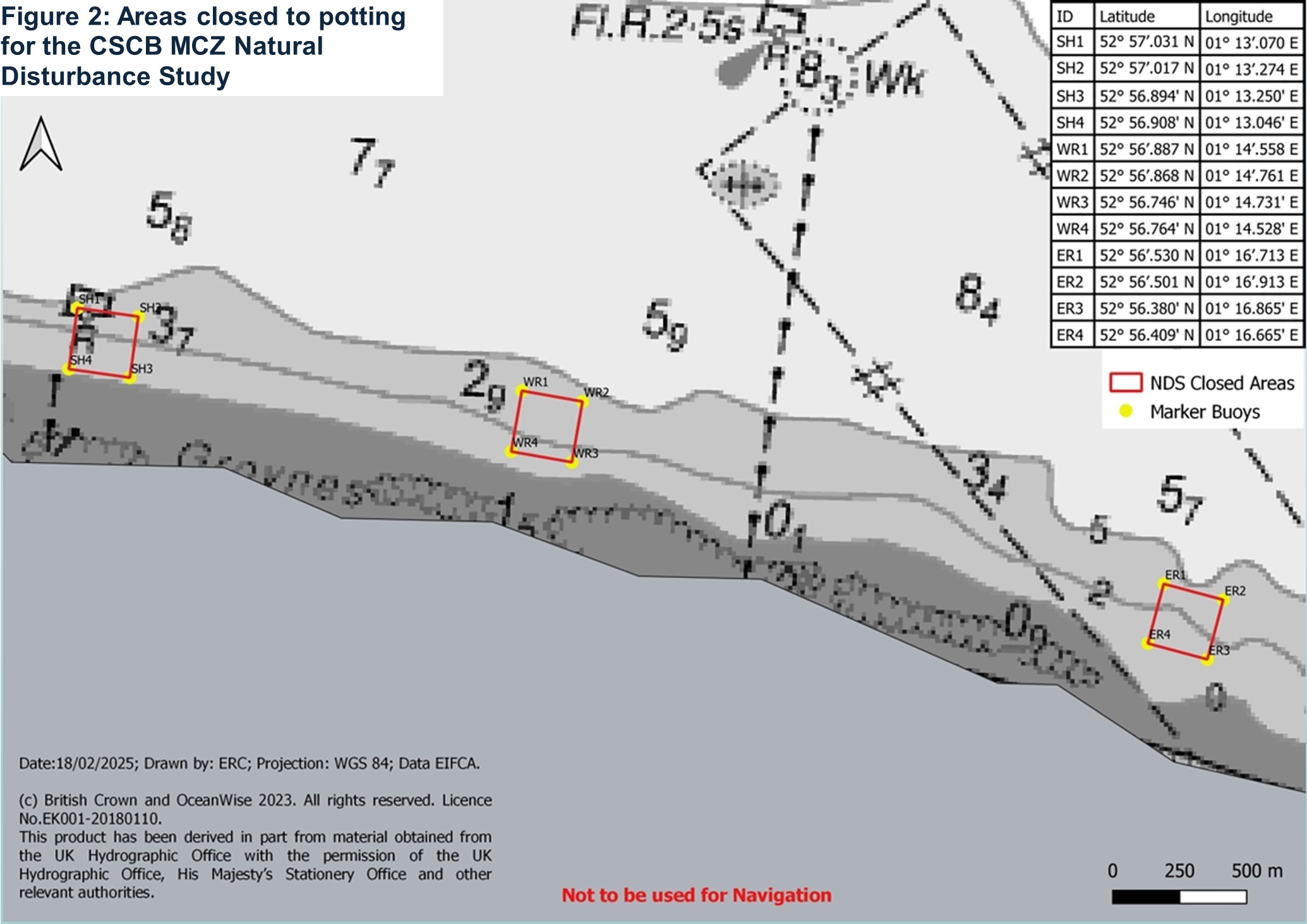
Closed areas
design sprint agency