MCZ page tabs (12)

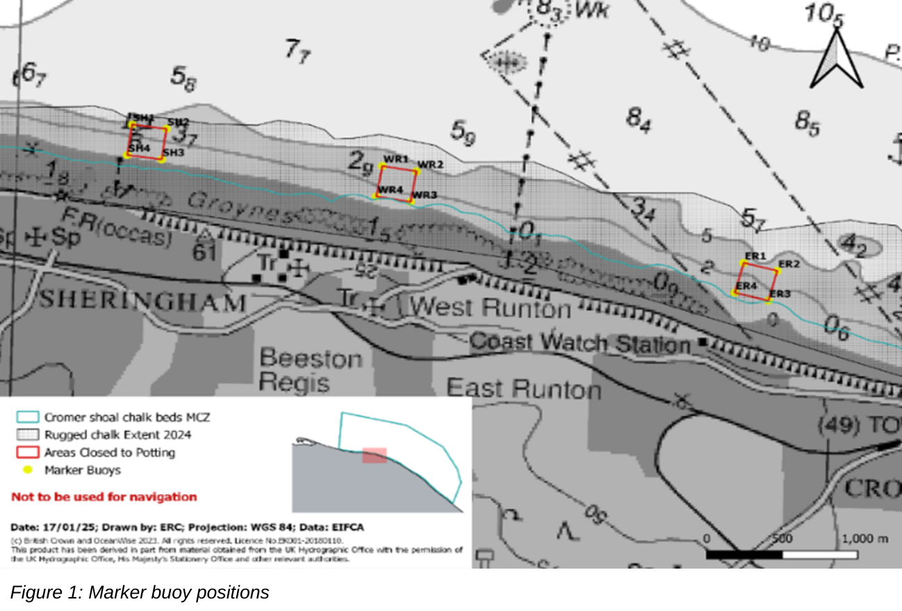
Map of Cromer Shoal Chalk Beds Marine Conservation Zone showing closed areas and rugged chalk extent along Sheringham, West Runton, and East Runton coastline. Gray nautical-chart base includes cyan MCZ boundary, red and orange closure polygons, labeled survey markers, north arrow, and 0–1,000 m scale bar

design sprint agency